Of the 17 Wards that make up Orleans Parish, the 9th has become it’s most well-known. In the 1920s, the Industrial Canal was dredged through the city’s largest ward, creating the “Upper” and “Lower” sections; “upper” referring to the section upriver from the canal to the west and “lower” as the downriver section to the east. In New Orleans, one tells direction based on the flow of the Mississippi, not the direction of the sun.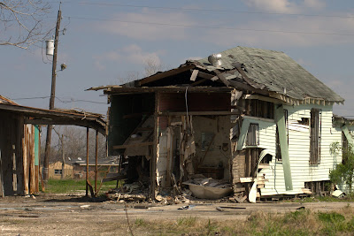 Much of the 9th Ward sits above sea level along the natural levee built by the Mississippi River. It is home to historic buildings, million dollar mansions, famous musicians (Fats Domino, Kermit Ruffins, as examples), and the famous Jackson Barracks. Like most of New Orleans, the streets of the Lower 9 are tree-lined, with corner stores, beauty parlors, and small restaurants.
The last census showed that the majority of the inhabitants owned their home and that more than half of them were retired. Of the homeowners, few held mortgages. They simply owned their home outright, having grown in that home and lived there for many years. One of our teachers at Abeona describes her home, flooded in the Gentilly neighborhood in the Upper 9th Ward, as “the pride of her family, her family home” and talks with a tear in her eye about how hard her parents worked to make it a home for her family.
(Note the water line on the stop sign above.) The picture was taken from the Holy Cross neighborhood in the Lower 9th Ward, between St. Claude and the River. Families must gut their homes in a timely manner in order to save them from demolition. Here, someone had gutted their home (from the appearance, this happened many months before). There are so many obstacles to overcome before rebuilding, yet the signs are clear that this area is loved and people want to return home.
In the Florida Avenue area (between Florida Avenue and St. Claude) — where the levee breach was so huge that a barge floated in and where water pushed in so fast and so hard that homes splintered off their foundations and cars were thrown like toys — all that remains are footprints. There are blocks and blocks of empty lots.
There may not be a house sitting on this land. But it is still someone’s home.
Photographs of what this area looked like after the storm may be viewed on Charlie Varley’s website. Click here to see his year after Katrina collection. Here are “then” and “one year later” shots. Note that the white house a few pictures above is the same one in his before and after collection (page 12); it is still sitting, collapsed, in the same position it was in after the flood.
A homeowner has made a sign to signal that this empty space is still 2026 Tennessee. The lot looks out to the newly constructed levee (the white wall) the St. Claude Drawbridge and the city skyline beyond. The Lower 9 has, in my opinion, one of the most beautiful views of the city.
A mailbox, labeled clearly for mail delivery, in front of a destroyed home.
A home sitting several feet off of its foundation.
This home has “do not demolish” signs on it at the request of a film crew.
Violet and I discussed the time frame for which the “HELP” was written. Finally, we decided that it didn’t matter when. Writing help on one of these destroyed buildings is just as relevant today as it was on August 29th, 2005.
A community reaches for faith to survive.
What would it mean if this were the only home you’ve ever known, the center of your family, the one thing that you own?
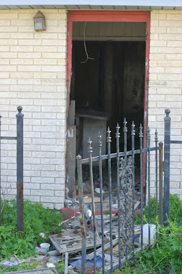 An open gate and open door, leading to…?
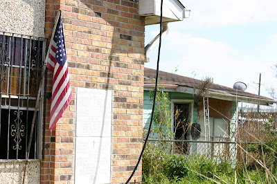

 Entergy at work (below).









Anonymous | 12-Mar-07 at 1:29 pm | Permalink
Wow, your pictures take my breath away. As a former resident of Chalmette and Metairie (who moved away in 2003), I am moved to tears. I worked down the street from the St. Claude drawbridge for a couple of years. This neighborhood is so close to home.
Holly | 12-Mar-07 at 4:09 pm | Permalink
Thank you for your comment. I appreciate both your memory of the area and your sentiment of the neighborhood. It reminds me of how the city means so much not only to the people that live here, but those who have moved away (or even just visited!) as well. Thank you!
Schroeder | 12-Mar-07 at 9:57 pm | Permalink
A strong post. I know you don’t do this newsworthy things much, but when you do, they’re great.
judyb | 16-Mar-07 at 10:10 am | Permalink
Thanks for this somber reminder that not too much has changed in the past 18 months. I’ve linked to this post from my blog, as I think everyone should see this.
Thanks again